

- Forecast
- Maps
- Live
- Weather State
- Spot Information
Cabo Roche Previsiones de Olas
/ Andalucia (56 surf breaks) /
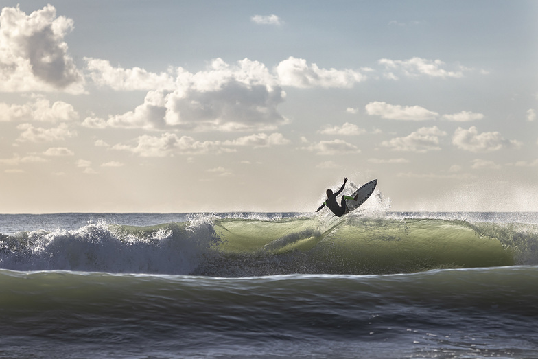
Surf en Cabo RochePronóstico / Andalucia / Spain
miércoles 13 | jueves 14 | viernes 15 | sábado 16 | domingo 17 | lunes 18 | martes 19 | miércoles 20 | jueves 21 | viernes 22 | sábado 23 | domingo 24 | |||||||||||||||||||||||||
| mañana | tarde | noche | mañana | tarde | noche | mañana | tarde | noche | mañana | tarde | noche | mañana | tarde | noche | mañana | tarde | noche | mañana | tarde | noche | mañana | tarde | noche | mañana | tarde | noche | mañana | tarde | noche | mañana | tarde | noche | mañana | tarde | noche | |
Notación (10 max) | ||||||||||||||||||||||||||||||||||||
Mapa de Altura de Olas |  |  |  |  |  |  |  | 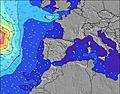 | 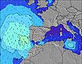 | 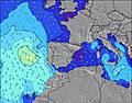 |  |  | ||||||||||||||||||||||||
| Altura de Olas (m) & dirección (?) | ||||||||||||||||||||||||||||||||||||
| Período(s) (?) | 10 | 15 | 13 | 13 | 6 | 14 | 12 | 12 | 11 | 9 | 9 | 8 | 8 | 8 | 8 | 7 | 7 | 7 | 7 | 6 | 6 | 11 | 11 | 10 | 10 | 10 | 9 | 13 | 12 | 11 | 11 | 10 | 10 | 9 | 11 | 10 |
Gráfico (?)Olas | ||||||||||||||||||||||||||||||||||||
| Energía (?) | 33 | 18 | 31 | 128 | 71 | 129 | 109 | 69 | 21 | 26 | 92 | 157 | 224 | 273 | 202 | 114 | 61 | 41 | 29 | 16 | 7 | 2 | 2 | 2 | 2 | 2 | 2 | 3 | 3 | 10 | 9 | 18 | 17 | 15 | 64 | 123 |
Viento (km/h) | ||||||||||||||||||||||||||||||||||||
| Estado del Viento (?) onshore Viento de Mar-Cruzado Cruzado Viento de Tierra-Cruzado Viento de Tierra Cristalino | cross- on | cross- on | cross- off | cross- off | cross | off | off | cross- off | off | off | off | off | cross- off | cross | cross- off | glass | on | on | cross- on | on | on | cross- off | cross- on | cross | cross | cross- on | cross- off | cross- off | cross- on | cross- off | off | cross- off | off | off | cross- off | cross- off |
Marea alta / altura (m) | 12:47PM 2.75 | 1:17AM 2.72 | 1:35PM 2.87 | 2:01AM 2.86 | 2:23PM 2.92 | 2:44AM 2.93 | 3:09PM 2.89 | 3:28AM 2.93 | 3:55PM 2.78 | 4:12AM 2.85 | 4:42PM 2.61 | 4:57AM 2.71 | 5:30PM 2.40 | 5:46AM 2.53 | 6:22PM 2.19 | 6:40AM 2.35 | 7:22PM 2.01 | 7:42AM 2.19 | 8:32PM 1.90 | 8:53AM 2.10 | 9:46PM 1.88 | 10:04AM 2.08 | 10:52PM 1.95 | |||||||||||||
Marea baja / altura (m) | 7:02PM 0.11 | 7:21AM 0.15 | 7:46PM 0.01 | 8:07AM 0.01 | 8:29PM -0.00 | 8:52AM -0.05 | 9:11PM 0.05 | 9:37AM -0.02 | 9:53PM 0.17 | 10:23AM 0.08 | 10:36PM 0.33 | 11:10AM 0.25 | 11:20PM 0.52 | 12:01PM 0.46 | 12:09AM 0.71 | 12:59PM 0.65 | 1:06AM 0.87 | 2:08PM 0.80 | 2:18AM 0.98 | 3:26PM 0.86 | 3:39AM 1.01 | 4:36PM 0.83 | ||||||||||||||
miércoles 13 | jueves 14 | viernes 15 | sábado 16 | domingo 17 | lunes 18 | martes 19 | miércoles 20 | jueves 21 | viernes 22 | sábado 23 | domingo 24 | |||||||||||||||||||||||||
| Amanecer | 8:00 | - | - | 8:00 | - | - | 8:02 | - | - | 8:03 | - | - | 8:03 | - | - | 8:04 | - | - | 8:06 | - | - | 8:07 | - | - | 8:07 | - | - | 8:08 | - | - | 8:10 | - | - | 8:11 | - | - |
| Puesta del Sol | - | 6:16 | - | - | 6:15 | - | - | 6:15 | - | - | 6:15 | - | - | 6:14 | - | - | 6:14 | - | - | 6:13 | - | - | 6:13 | - | - | 6:12 | - | - | 6:12 | - | - | 6:10 | - | - | 6:10 | - |
Lluvia (mm) | 2 | 2 | 9 | 5 | 5 | 6 | 1 | - | - | - | - | - | - | - | - | 1 | 1 | - | - | - | - | - | - | - | - | - | - | - | - | - | - | - | - | - | - | - |
| Temp. °C | 18 | 17 | 18 | 19 | 18 | 19 | 19 | 19 | 18 | 20 | 20 | 19 | 19 | 20 | 19 | 20 | 20 | 19 | 16 | 16 | 17 | 15 | 16 | 16 | 16 | 16 | 16 | 16 | 18 | 17 | 21 | 24 | 20 | 21 | 22 | 21 |
| Feels °C (?) | 15 | 16 | 15 | 16 | 15 | 18 | 13 | 13 | 11 | 15 | 18 | 17 | 18 | 20 | 21 | 18 | 19 | 18 | 14 | 13 | 16 | 14 | 14 | 13 | 14 | 14 | 14 | 15 | 17 | 15 | 18 | 21 | 15 | 15 | 18 | 16 |
Pronóstico Corto Plazo: Fuerte lluvia (totál 30mm), más pesada durante la noche de miércoles. Very mild (max 19°C el jueves por la mañana, min 16°C el miércoles por la tarde). Vientos crecientes (calma el miércoles por la tarde, casi tempestad desde el E por la noche de viernes). | Resumen del Tiempo Días 3-6 Lluvia ligera (totál 2mm), cayendo mayormente el lunes por la mañana. Warm (max 20°C el sábado por la mañana, min 16°C el lunes por la noche). Vientos decreciente (vientos fuertes desde el ESE el sábado por la mañana, calma por la noche de domingo). | Resumen del Tiempo Días 6-9 Mayormente seco. Very mild (max 17°C el martes por la noche, min 14°C el martes por la noche). El viento será generalmente ligero. | Pronóstico Largo Plazo: Mayormente seco. Warm (max 24°C el sábado por la tarde, min 14°C el viernes por la mañana). El viento será generalmente ligero. | |||||||||||||||||||||||||||||||||
- Map Icons:
 Break
Break Live Wave Height (m)
 Live Wind Speed (km/h)
 Surf Rating (10 Max)
 Ocean Swells (m)
- Wind Speed (km/h)
GRÁTIS! Un widget de Surf-Forecast.com para tu sitio
Este widget grátis de previsiones de surf y tiempo puede ser añadido a cualquier otro sitio y da un resumen de previsiones de olas para Cabo Roche. Solo necesita cortar y pegar el código HTML de abajo en su web. Puede elegir preferencias de idioma y de unidades (métricas o imperiales) para convenir a los usuarios de su sitio. Clica aquí para obtener el código.
Información sobre las previsiones de olas para Cabo Roche
La tabla de previsión de olas de arriba para Cabo Roche proporciona informaciones esenciales para determinar si las condiciones de oleajes serán buenas para los 12 próximos días. Una guía del spot para Cabo Roche se puede encontrar bajo el botón 'Info Spot' en el menú gris. Nuestras previsiones de olas para Cabo Roche son únicas porque damos una indicación de la energía de ola, dando una idea mejor y más real de la fuerza de las olas, en vez de sólo la altura o el período. Si surfea amenudo en Cabo Roche, haga una nota mental de la energía de ola de la tabla de previsión de olas cada vez que vaya. Rapidamente podrá escoger tus días de surf basado sólo en la energía de ola combinada con nuestra previsiones de viento. Nuestra notación (de 0 a 10 en las estrellas) le ayudará también. Además de las previsiones habituales de altura y período de olas, también encontrará descomposición completa de los diferentes componentes de olas en nuestras previsiones de olas avanzadas (clica en el pequeño carácter Einstein abajo de las marea).
Información adicional sobre respuestas a preguntas frecuentes acerca de nuestra previsión de olas para Cabo Roche se pueden encontrar bajo la etiqueta de ayuda en el menú de arriba y también moviendo el ratón sobre los signos de interrogación en la tabla de previsión de olas. Siempre tengan en mente que las previsiones son para aguas abiertas cercanas a las costa y factores locales pueden influenciar la altura verdadera de olas que rompe (perfil de la playa / del arrecife, profundidad de agua y refugio contra el viento).
Cabo Roche is 7 km (4 miles) from the city of Conil de la Frontera. If you plan a holiday in Andalucia, look for hotels and other accommodation in Conil de la Frontera. Conil de la Frontera has rooms for a wide range of budgets as well as car hire and transport links.


 Nearest