- Forecast
- Maps
- Live
- Weather State
- Spot Information
Previsiones:

Surf en Balnarring PointPronóstico / VIC – Mornington Peninsula / Australia
Actualizacion del pronostico en hora min s Forecast update imminent
La altura de oleaje para Balnarring Point es en mar abierto. Olas rompiendo en la orilla/arrecife son usualmente más pequeñas en áreas protegidas.
La temperatura del mar en Balnarring Point hoy es
20.2° C
(Lo cual es 2.2°C más cálido de lo normal para esta época del año)Actualizaciones en hora min s Forecast update imminent
domingo 08 | lunes 09 | martes 10 | miércoles 11 | |||||||||||||||||||||
| 2 PM | 5 PM | 8 PM | 11 PM | 2 AM | 5 AM | 8 AM | 11 AM | 2 PM | 5 PM | 8 PM | 11 PM | 2 AM | 5 AM | 8 AM | 11 AM | 2 PM | 5 PM | 8 PM | 11 PM | 2 AM | 5 AM | 8 AM | 11 AM | |
Notación (10 max) | ||||||||||||||||||||||||
Mapa de Altura de Olas |  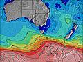  |    |  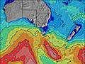  |  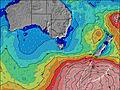 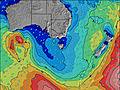 | ||||||||||||||||||||
| Altura de Olas (m) & dirección (?) | ||||||||||||||||||||||||
| Período(s) (?) | 14 | 14 | 14 | 14 | 14 | 13 | 13 | 13 | 13 | 13 | 13 | 12 | 12 | 12 | 12 | 12 | 12 | 12 | 12 | 12 | 12 | 12 | 12 | 11 |
Gráfico (?)Olas | ||||||||||||||||||||||||
| 1572 | 1443 | 1220 | 975 | 865 | 778 | 683 | 609 | 591 | 520 | 459 | 423 | 361 | 268 | 263 | 224 | 190 | 232 | 268 | 309 | 349 | 303 | 298 | 213 | |
Viento (km/h) | ||||||||||||||||||||||||
| Estado del Viento (?) onshore Viento de Mar-Cruzado Cruzado Viento de Tierra-Cruzado Viento de Tierra Cristalino | on | on | cross- on | cross- on | cross- on | cross | cross- off | cross- off | cross- off | cross- on | cross- on | cross | cross- off | cross- off | glass | glass | cross | on | on | cross- on | cross | cross- off | cross- off | off |
Marea alta / altura (m) | 5:35PM 2.98 | 5:32AM 2.86 | 6:10PM 2.97 | 6:01AM 2.80 | 6:43PM 2.91 | 6:28AM 2.72 | ||||||||||||||||||
Marea baja / altura (m) | 11:11AM 0.32 | 11:32PM 0.73 | 11:44AM 0.30 | 12:05AM 0.82 | 12:14PM 0.33 | 12:36AM 0.92 | ||||||||||||||||||
domingo 08 | lunes 09 | martes 10 | miércoles 11 | |||||||||||||||||||||
| Amanecer | - | - | - | - | - | - | 7:09 | - | - | - | - | - | - | - | 7:11 | - | - | - | - | - | - | - | 7:11 | - |
| Puesta del Sol | - | 7:50 | - | - | - | - | - | - | - | 7:49 | - | - | - | - | - | - | - | 7:46 | - | - | - | - | - | - |
Lluvia (mm) | - | - | - | - | - | - | - | - | - | - | - | - | - | - | - | - | - | - | - | - | - | - | - | - |
| Temp. °C | 19 | 20 | 18 | 17 | 17 | 16 | 16 | 20 | 23 | 19 | 18 | 17 | 17 | 17 | 17 | 17 | 19 | 20 | 19 | 20 | 19 | 20 | 23 | 24 |
| Feels °C (?) | 14 | 14 | 12 | 11 | 12 | 13 | 14 | 18 | 22 | 15 | 16 | 16 | 16 | 17 | 18 | 18 | 19 | 19 | 18 | 19 | 17 | 17 | 17 | 20 |
- Map Icons:
 Break
Break Live Wave Height (m)
 Live Wind Speed (km/h)
 Surf Rating (10 Max)
 Ocean Swells (m)
- Wind Speed (km/h)
GRÁTIS! Un widget de Surf-Forecast.com para tu sitio
Este widget grátis de previsiones de surf y tiempo puede ser añadido a cualquier otro sitio y da un resumen de previsiones de olas para Balnarring Point. Solo necesita cortar y pegar el código HTML de abajo en su web. Puede elegir preferencias de idioma y de unidades (métricas o imperiales) para convenir a los usuarios de su sitio. Clica aquí para obtener el código.
 Nearest