
Previsiones:

Pronóstico Corto PlazoLluvia moderada (totál 14mm), más pesada el viernes por la noche. Warm (max 31°C el sábado por la mañana, min 25°C el viernes por la noche). El viento será generalmente ligero. | ||||||||||||||||||||||||
jueves 30 | viernes 31 | sábado 1 | ||||||||||||||||||||||
2 AM | 5 AM | 8 AM | 11 AM | 2 PM | 5 PM | 8 PM | 11 PM | 2 AM | 5 AM | 8 AM | 11 AM | 2 PM | 5 PM | 8 PM | 11 PM | 2 AM | 5 AM | 8 AM | 11 AM | 2 PM | 5 PM | 8 PM | 11 PM | |
Mapa de Altura de Olas | 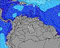 | 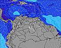 |  | 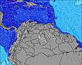 | 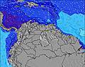 |  | 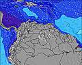 | 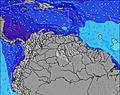 | 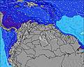 | |||||||||||||||
Oleaje Altura (m) Dirección Período (s) | NE 7 | NE 7 | NE 7 | NE 7 | ENE 7 | ENE 7 | ENE 7 | ENE 8 | ENE 8 | NE 8 | ENE 8 | ENE 8 | ENE 8 | ENE 7 | ENE 7 | ENE 7 | ENE 7 | NE 7 | ENE 7 | NE 7 | NE 7 | NE 7 | NE 7 | NE 7 |
Gráfico Olas | ||||||||||||||||||||||||
0 | 0 | 0 | 0 | 0 | 0 | 0 | 0 | 0 | 0 | 0 | 0 | 0 | 0 | 0 | 0 | 0 | 0 | 0 | 0 | 0 | 0 | 0 | 0 | |
Viento (km/h) | ||||||||||||||||||||||||
Estado del Viento Viento de Mar Viento de Mar-Cruzado Cruzado Viento de Tierra-Cruzado Viento de Tierra Cristalino | cross-off | cross-off | glassy | on | cross-on | cross-on | cross-on | cross | cross-off | off | glassy | on | cross-on | cross-on | cross | cross-off | off | cross-off | cross-off | glassy | glassy | glassy | cross-off | cross-off |
Marea alta | 1:19AM0.37m | 1:53AM0.34m | 5:33PM0.23m | |||||||||||||||||||||
Marea baja | 9:41AM0.07m | 9:53AM0.10m | 9:51AM0.12m | 8:17PM0.22m | ||||||||||||||||||||
— | 6:18 | — | — | — | — | — | — | — | 6:18 | — | — | — | — | — | — | — | 6:18 | — | — | — | — | — | — | |
— | — | — | — | — | 6:54 | — | — | — | — | — | — | — | 6:53 | — | — | — | — | — | — | — | 6:53 | — | — | |
mm | 2 | — | — | — | — | 1 | — | 1 | — | — | — | — | 1 | 3 | 1 | 2 | 1 | 4 | — | — | — | — | — | — |
Temp. °C | 26 | 25 | 27 | 30 | 30 | 27 | 26 | 26 | 26 | 26 | 28 | 29 | 28 | 27 | 26 | 26 | 26 | 25 | 25 | 31 | 31 | 30 | 28 | 26 |
Enfriamiento °C | 29 | 28 | 31 | 33 | 31 | 29 | 28 | 29 | 30 | 29 | 32 | 31 | 30 | 30 | 29 | 30 | 29 | 26 | 26 | 35 | 35 | 35 | 32 | 30 |
Oleaje 1 Altura (m) Dirección Período (s) | NE 7 | NE 7 | NE 7 | NE 7 | — | — | — | — | — | — | ENE 8 | — | — | — | — | ENE 7 | ENE 7 | NE 7 | ENE 7 | NE 7 | NE 7 | NE 7 | ENE 9 | NE 7 |
178 | 189 | 240 | 247 | — | — | — | — | — | — | 414 | — | — | — | — | 343 | 243 | 199 | 183 | 160 | 122 | 119 | 16 | 127 | |
Oleaje 2 Altura (m) Dirección Período (s) | — | — | — | — | — | — | — | — | — | — | — | — | — | — | — | — | — | — | — | — | — | — | — | ENE 9 |
— | — | — | — | — | — | — | — | — | — | — | — | — | — | — | — | — | — | — | — | — | — | — | 15 | |
Oleaje 3 Altura (m) Dirección Período (s) | — | — | — | — | — | — | — | — | — | — | — | — | — | — | — | — | — | — | — | — | — | — | — | — |
— | — | — | — | — | — | — | — | — | — | — | — | — | — | — | — | — | — | — | — | — | — | — | — | |
Olas de Viento Altura (m) Dirección Período (s) | — | — | — | — | ENE 7 | ENE 7 | ENE 7 | ENE 8 | ENE 8 | NE 8 | — | ENE 8 | ENE 8 | ENE 7 | ENE 7 | — | — | — | — | — | — | — | NE 7 | — |
— | — | — | — | 384 | 530 | 628 | 491 | 414 | 388 | — | 382 | 372 | 400 | 378 | — | — | — | — | — | — | — | 106 | — | |
Viento del Tierra o Mar Limpio más proximo | ||||||||||||||||||||||||
Distancia (km) | 4 | 4 | 4 | 84 | 84 | 84 | 84 | 5 | 4 | 4 | 4 | 84 | 84 | 84 | 21 | 4 | 4 | 5 | 5 | 4 | 4 | 4 | 4 | 4 |
Mejores Olas Previstas en Zona del Centro | ||||||||||||||||||||||||
Mejores Olas Previstas en Venezuela | ||||||||||||||||||||||||
Busca-Olas Global | ||||||||||||||||||||||||
- Map Icons:
 Break
Break Live Wave Height (m)
 Live Wind Speed (km/h)
 Surf Rating (10 Max)
 Ocean Swells (m)
- Wind Speed (km/h)
GRÁTIS! Un widget de Surf-Forecast.com para tu sitio
Este widget grátis de previsiones de surf y tiempo puede ser añadido a cualquier otro sitio y da un resumen de previsiones de olas para Bahia de Cata. Solo necesita cortar y pegar el código HTML de abajo en su web. Puede elegir preferencias de idioma y de unidades (métricas o imperiales) para convenir a los usuarios de su sitio. Clica aquí para obtener el código.
 Nearest