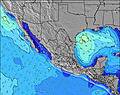
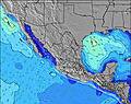
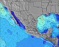
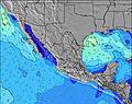
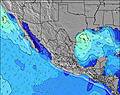
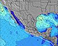
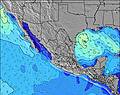
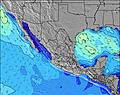
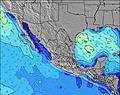
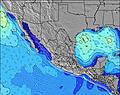
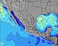
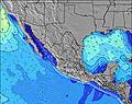
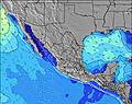
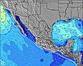
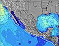
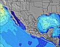
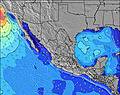
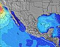
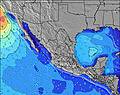
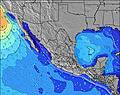
ClippertonIsland Mapa del tiempo
Volver a los Mapas Estáticos | Ir a Mapas Dinámicos
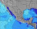
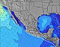
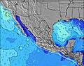
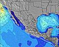
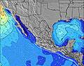
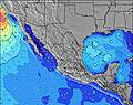
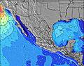
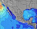
Otros periodos del Mapa de Altura de Ola:
![]() |
![]() |
![]() |
![]() |
![]() |
![]() |
![]() |
![]() |
![]() |
![]() |
![]() |
![]() |
![]() |
![]() |
![]() |
![]() |
![]() |
![]() |
![]() |
![]() |
![]() |
![]() |
![]() |
![]() |
![]() |
![]() |
![]() |
![]() |
![]() |
![]() |
Volver a los Mapas Estáticos | Ir a Mapas Dinámicos
![]() |
![]() |
![]() |
![]() |
![]() |
![]() |
![]() |
![]() |
![]() |
![]() |
![]() |
![]() |
![]() |
![]() |
![]() |
![]() |
![]() |
![]() |
![]() |
![]() |
![]() |
![]() |
![]() |
![]() |
![]() |
![]() |
![]() |
![]() |
![]() |
![]() |
© 2025 Snow-Forecast.com | Terms of Service | Privacy | Cookie Policy