

- Forecast
- Maps
- Live
- Weather State
- Spot Information
Tarantulas Surf Forecast
/ CAL – Santa Barbara (36 breaks) / California (404 breaks) /
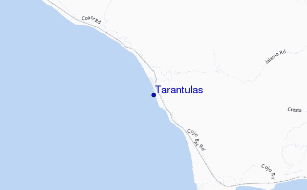
Tarantulas surf Forecast / CAL – Santa Barbara / USA
- Map Icons:
 Break
Break Live Wave Height (m)
 Live Wind Speed (km/h)
 Surf Rating (10 Max)
 Ocean Swells (m)
- Wind Speed (km/h)
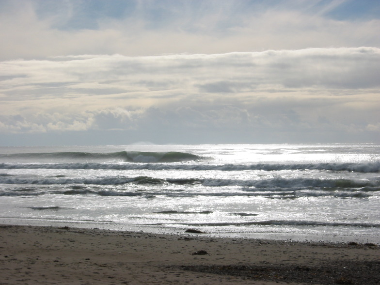
How big are the waves at Tarantulas today?
The current surf forecast for Tarantulas at 3PM is: 1.1m 10s primary swell from a Northwest direction and 0.6m 16s secondary swell from a Southwest direction, 0.4m 3s secondary swell from a Northwest direction (forecast issued at 10:00am April 24). The wind direction is predicted to be cross-shore.
| Time (PDT) & Date | Wave Height | Wave Period |
|---|---|---|
| Morning (24 Apr) | 4ft (1.2m) | 10s |
| Afternoon (24 Apr) | 3.5ft (1.1m) | 10s |
| Evening (24 Apr) | 4ft (1.2m) | 10s |
Table - waves today at Tarantulas. (Swell directed towards the surf break)
Wednesday 24 | Thursday 25 | Friday 26 | Saturday 27 | Sunday 28 | Monday 29 | Tuesday 30 | Wednesday 01 | |||||||||||||||||||||||||||||||||||||||||||||||||||||
| 8 AM | 11 AM | 2 PM | 5 PM | 8 PM | 11 PM | 2 AM | 5 AM | 8 AM | 11 AM | 2 PM | 5 PM | 8 PM | 11 PM | 2 AM | 5 AM | 8 AM | 11 AM | 2 PM | 5 PM | 8 PM | 11 PM | 2 AM | 5 AM | 8 AM | 11 AM | 2 PM | 5 PM | 8 PM | 11 PM | 2 AM | 5 AM | 8 AM | 11 AM | 2 PM | 5 PM | 8 PM | 11 PM | 2 AM | 5 AM | 8 AM | 11 AM | 2 PM | 5 PM | 8 PM | 11 PM | 2 AM | 5 AM | 8 AM | 11 AM | 2 PM | 5 PM | 8 PM | 11 PM | 2 AM | 5 AM | 8 AM | 11 AM | 2 PM | 5 PM | |
Rating (10 max) | ||||||||||||||||||||||||||||||||||||||||||||||||||||||||||||
Swell Height Map |    |    |    |    |    |   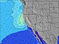 |  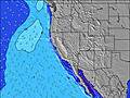 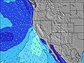 | 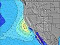   | ||||||||||||||||||||||||||||||||||||||||||||||||||||
| Wave Height (m) & direction (?) | ||||||||||||||||||||||||||||||||||||||||||||||||||||||||||||
| Period(s) (?) | 10 | 10 | 10 | 10 | 10 | 10 | 10 | 9 | 9 | 9 | 7 | 7 | 8 | 8 | 7 | 7 | 6 | 18 | 7 | 8 | 8 | 8 | 8 | 9 | 9 | 9 | 9 | 9 | 9 | 9 | 9 | 9 | 8 | 8 | 8 | 8 | 8 | 9 | 8 | 8 | 8 | 8 | 8 | 9 | 9 | 10 | 10 | 10 | 10 | 10 | 11 | 10 | 10 | 9 | 9 | 8 | 8 | 8 | 8 | 11 |
Wave (?)Graph | ||||||||||||||||||||||||||||||||||||||||||||||||||||||||||||
| Energy (?) | 294 | 267 | 220 | 220 | 251 | 196 | 211 | 182 | 182 | 287 | 296 | 612 | 1006 | 1004 | 569 | 374 | 282 | 341 | 567 | 932 | 1392 | 1364 | 1432 | 1448 | 1270 | 1175 | 1175 | 1201 | 1516 | 1814 | 1731 | 1325 | 987 | 908 | 1019 | 1405 | 1534 | 1646 | 1255 | 1091 | 1044 | 1095 | 1159 | 1186 | 1175 | 1310 | 1876 | 1876 | 1280 | 1288 | 1168 | 1283 | 1104 | 1089 | 1042 | 929 | 666 | 515 | 329 | 792 |
Wind (km/h) | ||||||||||||||||||||||||||||||||||||||||||||||||||||||||||||
| Wind State (?) onshore cross-onshore cross-shore cross-offshore offshore glassy | cross- off | cross | cross | cross | cross | cross | cross- off | cross- off | cross- off | cross | cross | cross | cross- off | cross- off | cross- off | cross- off | cross- off | cross | cross | cross | cross | cross- off | cross- off | cross- off | cross- off | cross | cross | cross- off | cross- off | cross- off | cross- off | cross- off | cross- off | cross | cross | cross- off | cross- off | cross- off | cross- off | cross- off | cross- off | cross | cross | cross- off | cross- off | cross- off | cross- off | cross- off | cross- off | cross | cross | cross- off | cross- off | cross- off | cross- off | cross- off | cross- off | cross | cross | cross- off |
High Tide / height (m) | 11:22AM 1.53 | 10:25PM 2.06 | 12:10PM 1.45 | 10:51PM 2.06 | 1:07PM 1.38 | 11:21PM 2.04 | 2:23PM 1.32 | 11:58PM 2.00 | 4:31PM 1.32 | 12:45AM 1.95 | 1:51AM 1.87 | 6:27PM 1.48 | 3:17AM 1.81 | |||||||||||||||||||||||||||||||||||||||||||||||
Low Tide / height (m) | 4:13PM 1.01 | 5:38AM 0.34 | 4:34PM 1.11 | 6:20AM 0.34 | 4:53PM 1.19 | 7:09AM 0.37 | 5:09PM 1.26 | 8:07AM 0.39 | 5:08PM 1.32 | 9:13AM 0.40 | 10:19AM 0.39 | 9:27PM 1.42 | 11:18AM 0.37 | |||||||||||||||||||||||||||||||||||||||||||||||
Wednesday 24 | Thursday 25 | Friday 26 | Saturday 27 | Sunday 28 | Monday 29 | Tuesday 30 | Wednesday 01 | |||||||||||||||||||||||||||||||||||||||||||||||||||||
| Sunrise | 6:18 | - | - | - | - | - | - | - | 6:16 | - | - | - | - | - | - | - | 6:16 | - | - | - | - | - | - | - | 6:15 | - | - | - | - | - | - | - | 6:13 | - | - | - | - | - | - | - | 6:13 | - | - | - | - | - | - | - | 6:11 | - | - | - | - | - | - | - | 6:11 | - | - | - |
| Sunset | - | - | - | 7:40 | - | - | - | - | - | - | - | 7:42 | - | - | - | - | - | - | - | 7:43 | - | - | - | - | - | - | - | 7:44 | - | - | - | - | - | - | - | 7:44 | - | - | - | - | - | - | - | 7:45 | - | - | - | - | - | - | - | 7:45 | - | - | - | - | - | - | - | 7:46 |
Rain (mm) | - | - | - | - | - | - | - | - | - | - | - | - | - | - | - | - | - | - | - | - | - | - | - | - | - | - | - | - | - | - | - | - | - | - | - | - | - | - | - | - | - | - | - | - | - | - | - | - | - | - | - | - | - | - | - | - | - | - | - | - |
| Temp. °C | 12 | 14 | 13 | 14 | 13 | 13 | 12 | 11 | 12 | 13 | 13 | 13 | 12 | 12 | 12 | 12 | 12 | 14 | 15 | 14 | 13 | 12 | 11 | 10 | 12 | 14 | 14 | 14 | 11 | 11 | 11 | 11 | 12 | 15 | 16 | 14 | 12 | 11 | 11 | 11 | 12 | 15 | 16 | 13 | 11 | 11 | 11 | 11 | 13 | 17 | 17 | 15 | 11 | 11 | 10 | 10 | 11 | 14 | 14 | 13 |
| Feels °C (?) | 10 | 10 | 9 | 9 | 9 | 11 | 10 | 8 | 9 | 8 | 6 | 6 | 6 | 5 | 5 | 6 | 8 | 8 | 7 | 6 | 5 | 4 | 6 | 4 | 7 | 8 | 7 | 7 | 5 | 5 | 6 | 7 | 7 | 9 | 10 | 7 | 5 | 4 | 5 | 6 | 6 | 9 | 9 | 6 | 5 | 5 | 6 | 6 | 9 | 13 | 12 | 10 | 6 | 6 | 5 | 6 | 7 | 9 | 8 | 7 |
FREE! Surf-Forecast.com widget for your website
The surf report / weather widget below is available to embed on third party websites free of charge and provides a summary of our Tarantulas surf forecast. Simply grab the html code snippet that we provide and paste it into your own site. You can choose your preferred language and metric/imperial units for the surf forecast feed to suit users of your site. Click here to get the code.


 Nearest