

- Forecast
- Maps
- Live
- Weather State
- Spot Information
Sele Surf Forecast
/ South and West (14 surf breaks) /
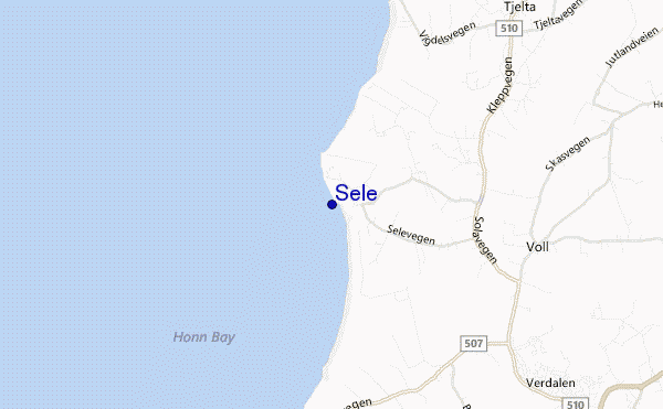
Sele surf Forecast / South and West / Norway
- Map Icons:
 Break
Break Live Wave Height (m)
 Live Wind Speed (km/h)
 Surf Rating (10 Max)
 Ocean Swells (m)
- Wind Speed (km/h)
How big are the waves at Sele today?
The current surf forecast for Sele at 1AM is: 0.4m 12s primary swell from a West-northwest direction and 0.5m 6s secondary swell from a West direction (forecast issued at 07:00pm April 18). An open ocean swell of 1.0m 4s is not directed at the surf break. The wind direction is predicted to be cross-offshore.
| Time (CEST) & Date | Wave Height | Wave Period |
|---|---|---|
| Morning (19 Apr) | 2ft (0.6m) | 11s |
| Afternoon (19 Apr) | 4.5ft (1.3m) | 8s |
| Evening (19 Apr) | 8ft (2.5m) | 10s |
Table - waves today at Sele. (Swell directed towards the surf break)
Thursday 18 | Friday 19 | Saturday 20 | Sunday 21 | Monday 22 | Tuesday 23 | Wednesday 24 | Thursday 25 | Fri 26 | ||||||||||||||||||||||||||||||||||||||||||||||||||||
| 5 PM | 8 PM | 11 PM | 2 AM | 5 AM | 8 AM | 11 AM | 2 PM | 5 PM | 8 PM | 11 PM | 2 AM | 5 AM | 8 AM | 11 AM | 2 PM | 5 PM | 8 PM | 11 PM | 2 AM | 5 AM | 8 AM | 11 AM | 2 PM | 5 PM | 8 PM | 11 PM | 2 AM | 5 AM | 8 AM | 11 AM | 2 PM | 5 PM | 8 PM | 11 PM | 2 AM | 5 AM | 8 AM | 11 AM | 2 PM | 5 PM | 8 PM | 11 PM | 2 AM | 5 AM | 8 AM | 11 AM | 2 PM | 5 PM | 8 PM | 11 PM | 2 AM | 5 AM | 8 AM | 11 AM | 2 PM | 5 PM | 8 PM | 11 PM | 2 AM | |
Rating (10 max) | ||||||||||||||||||||||||||||||||||||||||||||||||||||||||||||
Swell Height Map |    | 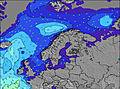 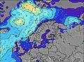 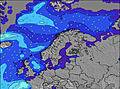 | 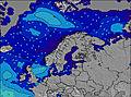 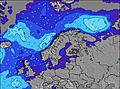 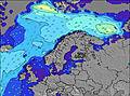 | 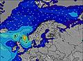 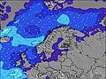 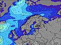 | 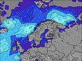 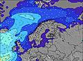 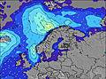 | 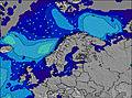 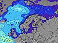 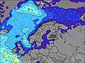 | 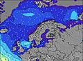 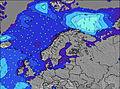 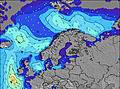 | 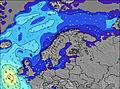 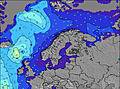 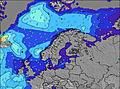 | 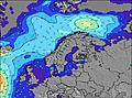 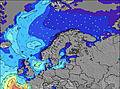 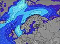 | |||||||||||||||||||||||||||||||||||||||||||||||||||
| Wave Height (m) & direction (?) | ||||||||||||||||||||||||||||||||||||||||||||||||||||||||||||
| Period(s) (?) | 8 | 8 | 12 | 12 | 12 | 11 | 11 | 8 | 10 | 10 | 10 | 11 | 11 | 11 | 10 | 10 | 10 | 9 | 9 | 9 | 8 | 8 | 8 | 8 | 8 | 8 | 8 | 8 | 7 | 7 | 9 | 9 | 10 | 12 | 11 | 11 | 10 | 10 | 9 | 6 | 6 | 7 | 8 | 8 | 9 | 9 | 9 | 9 | 8 | 8 | 8 | 8 | 8 | 8 | 7 | 7 | 7 | 7 | 7 | 7 |
Wave (?)Graph | ||||||||||||||||||||||||||||||||||||||||||||||||||||||||||||
| Energy (?) | 37 | 23 | 28 | 48 | 46 | 65 | 95 | 146 | 499 | 1402 | 2119 | 2500 | 2135 | 1656 | 1616 | 1224 | 929 | 853 | 573 | 370 | 227 | 149 | 93 | 64 | 41 | 31 | 21 | 20 | 14 | 10 | 16 | 29 | 31 | 109 | 126 | 90 | 77 | 72 | 65 | 157 | 374 | 689 | 838 | 752 | 571 | 790 | 580 | 528 | 545 | 575 | 463 | 364 | 291 | 359 | 262 | 152 | 109 | 73 | 77 | 22 |
Wind (km/h) | ||||||||||||||||||||||||||||||||||||||||||||||||||||||||||||
| Wind State (?) onshore cross-onshore cross-shore cross-offshore offshore glassy | cross | cross- off | cross- off | cross- off | cross- off | cross- off | cross- off | cross- off | cross- on | cross | cross- off | cross- off | cross | cross | cross- on | cross | cross | cross | cross | cross- off | off | cross- off | cross | on | on | cross- on | cross | glass | glass | glass | cross- on | on | cross | cross- off | cross- off | cross- off | cross | cross | cross | cross- on | cross | cross | cross | cross | cross | cross- off | cross- off | cross | cross | cross | off | cross- off | cross- off | off | off | cross- off | cross- off | cross- off | glass | cross- off |
High Tide / height (m) | 10:15PM 0.18 | 8:28AM 0.22 | 10:05PM 0.21 | 9:36AM 0.24 | 10:19PM 0.24 | 10:14AM 0.26 | 10:43PM 0.27 | 10:47AM 0.29 | 11:11PM 0.29 | 11:21AM 0.30 | 11:41PM 0.32 | 11:55AM 0.31 | 12:12AM 0.33 | 12:29PM 0.32 | 12:44AM 0.34 | |||||||||||||||||||||||||||||||||||||||||||||
Low Tide / height (m) | 2:31PM 0.12 | 2:44AM 0.14 | 3:34PM 0.10 | 3:45AM 0.12 | 4:16PM 0.08 | 4:27AM 0.10 | 4:48PM 0.06 | 5:00AM 0.07 | 5:14PM 0.05 | 5:26AM 0.06 | 5:33PM 0.04 | 5:47AM 0.04 | 5:49PM 0.03 | 6:06AM 0.03 | 6:07PM 0.03 | |||||||||||||||||||||||||||||||||||||||||||||
Thursday 18 | Friday 19 | Saturday 20 | Sunday 21 | Monday 22 | Tuesday 23 | Wednesday 24 | Thursday 25 | Fri 26 | ||||||||||||||||||||||||||||||||||||||||||||||||||||
| Sunrise | - | - | - | - | - | 6:11 | - | - | - | - | - | - | - | 6:09 | - | - | - | - | - | - | - | 6:07 | - | - | - | - | - | - | - | 6:03 | - | - | - | - | - | - | - | 6:01 | - | - | - | - | - | - | - | 5:58 | - | - | - | - | - | - | - | 5:56 | - | - | - | - | - | - |
| Sunset | - | 9:00 | - | - | - | - | - | - | - | 9:01 | - | - | - | - | - | - | - | 9:04 | - | - | - | - | - | - | - | 9:07 | - | - | - | - | - | - | - | 9:08 | - | - | - | - | - | - | - | 9:10 | - | - | - | - | - | - | - | 9:14 | - | - | - | - | - | - | - | 9:15 | - | - |
Rain (mm) | - | - | 1 | 2 | 2 | 1 | - | - | - | - | - | - | - | - | - | - | - | - | - | - | - | - | - | - | - | - | - | - | - | - | - | - | 1 | 1 | - | - | - | - | - | - | - | - | - | - | - | - | - | - | - | - | - | - | - | - | - | - | 1 | - | - | - |
| Temp. °C | 5 | 4 | 3 | 3 | 3 | 4 | 6 | 7 | 5 | 4 | 3 | 4 | 4 | 4 | 5 | 5 | 6 | 6 | 6 | 7 | 7 | 7 | 7 | 7 | 7 | 6 | 6 | 6 | 5 | 5 | 5 | 3 | 2 | 3 | 4 | 4 | 5 | 4 | 5 | 5 | 6 | 6 | 6 | 6 | 6 | 6 | 7 | 8 | 9 | 8 | 8 | 7 | 7 | 7 | 8 | 9 | 8 | 8 | 7 | 7 |
| Feels °C (?) | -3 | -4 | -6 | -6 | -6 | -4 | -1 | 2 | 0 | -2 | -4 | -2 | 1 | -1 | -2 | -2 | -1 | -1 | 1 | 4 | 4 | 3 | 2 | 1 | 3 | 3 | 3 | 4 | 3 | 2 | 2 | -2 | -2 | -2 | 0 | 0 | -3 | -6 | -5 | -6 | -3 | -2 | 0 | 1 | 1 | 0 | 1 | 2 | 4 | 4 | 3 | 2 | 3 | 2 | 2 | 5 | 5 | 5 | 5 | 4 |
FREE! Surf-Forecast.com widget for your website
The surf report / weather widget below is available to embed on third party websites free of charge and provides a summary of our Sele surf forecast. Simply grab the html code snippet that we provide and paste it into your own site. You can choose your preferred language and metric/imperial units for the surf forecast feed to suit users of your site. Click here to get the code.


 Nearest