

- Forecast
- Maps
- Live
- Weather State
- Spot Information

Surf Forecasts
Reef
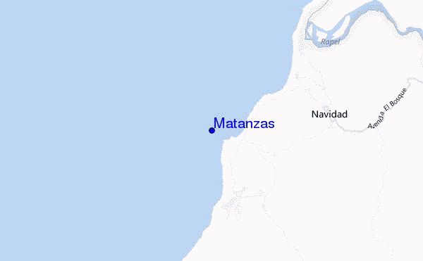
Matanzas surf Forecast / Santiago / Chile
48hr Weather and Surf, issued 1 am Wednesday 24 Apr 2024 -04
Forecast update in hr min s Update imminent
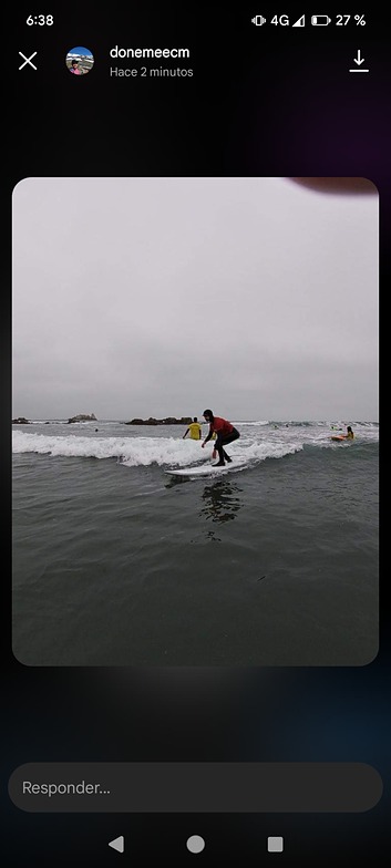
Matanzas surf forecast is for near shore open water. Breaking waves will often be smaller at less exposed spots.
Today's Matanzas sea temperature is 13.0°C (Statistics for 24 Apr 1981-2005 - mean: 15.1 °C max: 16.4 °C min: 14.1 °C)
- Map Icons:
 Break
Break Live Wave Height (m)
 Live Wind Speed (km/h)
 Surf Rating (10 Max)
 Ocean Swells (m)
- Wind Speed (km/h)
Matanzas surf forecast is for near shore open water. Breaking waves will often be smaller at less exposed spots.
Today's Matanzas sea temperature is 13.0°C (Statistics for 24 Apr 1981-2005 - mean: 15.1 °C max: 16.4 °C min: 14.1 °C)
How big are the waves at Matanzas today?
The current surf forecast for Matanzas at 7AM is: 1.1m 16s primary swell from a Southwest direction and 0.8m 6s secondary swell from a Southwest direction (forecast issued at 01:00am April 24). The wind direction is predicted to be cross-shore and the swell rating is 3.
| Time (-04) & Date | Wave Height | Wave Period |
|---|---|---|
| Morning (24 Apr) | 3.5ft (1.1m) | 16s |
| Afternoon (24 Apr) | 3.5ft (1.1m) | 15s |
| Evening (24 Apr) | 3.5ft (1.0m) | 14s |
Table - waves today at Matanzas. (Swell directed towards the surf break)
Updates in hr min s Update imminent
Wednesday 24 | Thursday 25 | Friday 26 | Saturday 27 | Sunday 28 | Monday 29 | Tuesday 30 | Wednesday 01 | |||||||||||||||||||||||||||||||||||||||||||||||||||||
| 11 PM | 2 AM | 5 AM | 8 AM | 11 AM | 2 PM | 5 PM | 8 PM | 11 PM | 2 AM | 5 AM | 8 AM | 11 AM | 2 PM | 5 PM | 8 PM | 11 PM | 2 AM | 5 AM | 8 AM | 11 AM | 2 PM | 5 PM | 8 PM | 11 PM | 2 AM | 5 AM | 8 AM | 11 AM | 2 PM | 5 PM | 8 PM | 11 PM | 2 AM | 5 AM | 8 AM | 11 AM | 2 PM | 5 PM | 8 PM | 11 PM | 2 AM | 5 AM | 8 AM | 11 AM | 2 PM | 5 PM | 8 PM | 11 PM | 2 AM | 5 AM | 8 AM | 11 AM | 2 PM | 5 PM | 8 PM | 11 PM | 2 AM | 5 AM | 8 AM | |
Rating (10 max) | ||||||||||||||||||||||||||||||||||||||||||||||||||||||||||||
Swell Height Map |  |  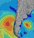 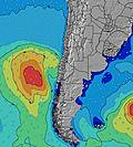 |    |    | 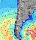 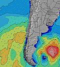 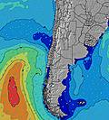 | 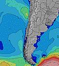 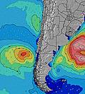 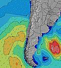 | 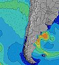 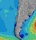 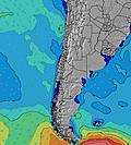 | 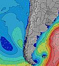 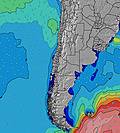 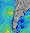 |    | |||||||||||||||||||||||||||||||||||||||||||||||||||
| Wave Height (m) & direction (?) | ||||||||||||||||||||||||||||||||||||||||||||||||||||||||||||
| Period(s) (?) | 15 | 15 | 16 | 16 | 16 | 16 | 15 | 15 | 17 | 17 | 15 | 16 | 16 | 16 | 16 | 16 | 14 | 11 | 11 | 14 | 12 | 12 | 12 | 12 | 12 | 13 | 15 | 15 | 15 | 15 | 14 | 14 | 14 | 14 | 14 | 14 | 13 | 13 | 13 | 13 | 13 | 13 | 13 | 12 | 12 | 12 | 16 | 16 | 15 | 15 | 15 | 15 | 14 | 14 | 14 | 14 | 13 | 13 | 13 | 13 |
Wave (?)Graph | ||||||||||||||||||||||||||||||||||||||||||||||||||||||||||||
| Energy (?) | 313 | 512 | 619 | 627 | 635 | 619 | 623 | 479 | 354 | 350 | 623 | 603 | 627 | 719 | 710 | 1305 | 1321 | 694 | 563 | 565 | 494 | 918 | 1167 | 1369 | 1451 | 1982 | 2717 | 2868 | 2830 | 2863 | 2247 | 2635 | 2562 | 2125 | 1680 | 1401 | 1266 | 1137 | 1120 | 940 | 790 | 790 | 710 | 677 | 656 | 677 | 1654 | 1634 | 1437 | 1363 | 1229 | 1237 | 1468 | 899 | 957 | 878 | 919 | 984 | 1069 | 1053 |
Wind (km/h) | ||||||||||||||||||||||||||||||||||||||||||||||||||||||||||||
| Wind State (?) onshore cross-onshore cross-shore cross-offshore offshore glassy | cross | cross | cross | cross- off | cross- on | cross- on | cross- on | cross | cross- off | cross- off | cross- off | cross- off | cross- on | cross- on | cross- on | cross | cross | cross | cross- off | cross- off | cross- on | cross- on | cross- on | cross | cross | cross | cross | cross | cross | cross- on | cross- on | cross | cross | cross | cross | cross | cross- on | cross- on | cross- on | cross- on | cross- off | cross- off | cross- off | off | cross | cross- on | cross- on | glass | cross- off | cross- off | off | off | cross- off | cross- on | cross | cross | glass | glass | glass | cross- off |
High Tide / height (m) | 10:39AM 1.34 | 10:58PM 1.05 | 11:09AM 1.37 | 11:31PM 0.98 | 11:41AM 1.36 | 12:07AM 0.91 | 12:17PM 1.33 | 12:47AM 0.83 | 12:59PM 1.29 | 1:38AM 0.75 | 1:50PM 1.25 | 2:47AM 0.70 | 2:55PM 1.21 | 4:19AM 0.70 | ||||||||||||||||||||||||||||||||||||||||||||||
Low Tide / height (m) | 4:18AM 0.18 | 5:03PM 0.15 | 4:43AM 0.21 | 5:41PM 0.17 | 5:09AM 0.25 | 6:20PM 0.21 | 5:37AM 0.30 | 7:06PM 0.25 | 6:09AM 0.35 | 8:00PM 0.30 | 6:47AM 0.40 | 9:10PM 0.33 | 7:42AM 0.45 | 10:29PM 0.31 | ||||||||||||||||||||||||||||||||||||||||||||||
Wednesday 24 | Thursday 25 | Friday 26 | Saturday 27 | Sunday 28 | Monday 29 | Tuesday 30 | Wednesday 01 | |||||||||||||||||||||||||||||||||||||||||||||||||||||
| Sunrise | - | - | - | 7:16 | - | - | - | - | - | - | - | 7:18 | - | - | - | - | - | - | - | 7:18 | - | - | - | - | - | - | - | 7:20 | - | - | - | - | - | - | - | 7:20 | - | - | - | - | - | - | - | 7:20 | - | - | - | - | - | - | - | 7:22 | - | - | - | - | - | - | - | 7:22 |
| Sunset | - | - | - | - | - | - | 6:12 | - | - | - | - | - | - | - | 6:10 | - | - | - | - | - | - | - | 6:09 | - | - | - | - | - | - | - | 6:08 | - | - | - | - | - | - | - | 6:07 | - | - | - | - | - | - | - | 6:07 | - | - | - | - | - | - | - | 6:06 | - | - | - | - | - |
Rain (mm) | - | - | - | - | - | - | - | - | - | - | - | - | - | - | - | - | - | - | - | - | - | - | - | - | - | - | - | - | - | - | - | - | - | - | - | - | - | - | - | - | - | - | - | - | - | - | - | - | - | - | - | - | - | - | - | - | - | - | - | 1 |
| Temp. °C | 13 | 13 | 12 | 12 | 15 | 16 | 15 | 13 | 13 | 14 | 14 | 14 | 17 | 17 | 16 | 15 | 14 | 14 | 14 | 14 | 16 | 17 | 15 | 13 | 13 | 13 | 12 | 11 | 13 | 15 | 14 | 12 | 11 | 11 | 11 | 11 | 14 | 15 | 14 | 13 | 12 | 12 | 12 | 12 | 15 | 16 | 15 | 14 | 14 | 13 | 13 | 13 | 16 | 16 | 16 | 15 | 15 | 15 | 14 | 14 |
| Feels °C (?) | 10 | 11 | 10 | 10 | 12 | 12 | 11 | 10 | 10 | 11 | 10 | 10 | 14 | 14 | 13 | 14 | 13 | 13 | 12 | 13 | 14 | 14 | 11 | 9 | 9 | 8 | 7 | 6 | 8 | 8 | 7 | 6 | 6 | 7 | 7 | 7 | 10 | 10 | 9 | 10 | 10 | 11 | 11 | 11 | 14 | 14 | 14 | 14 | 13 | 12 | 12 | 12 | 14 | 14 | 14 | 14 | 14 | 15 | 14 | 14 |
FREE! Surf-Forecast.com widget for your website
The surf report / weather widget below is available to embed on third party websites free of charge and provides a summary of our Matanzas surf forecast. Simply grab the html code snippet that we provide and paste it into your own site. You can choose your preferred language and metric/imperial units for the surf forecast feed to suit users of your site. Click here to get the code.


 Nearest