

- Forecast
- Maps
- Live
- Weather State
- Spot Information

Surf Forecasts
Reef And Point
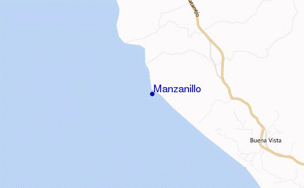
Manzanillo surf Forecast / Guerrero / Mexico
48hr Weather and Surf, issued 12 am Friday 19 Apr 2024 CDT
Forecast update in hr min s Update imminent
Manzanillo surf forecast is for near shore open water. Breaking waves will often be smaller at less exposed spots.
Today's Manzanillo sea temperature is 25.6°C (Statistics for 19 Apr 1981-2005 - mean: 27.0 °C max: 28.7 °C min: 25.5 °C)
- Map Icons:
 Break
Break Live Wave Height (m)
 Live Wind Speed (km/h)
 Surf Rating (10 Max)
 Ocean Swells (m)
- Wind Speed (km/h)
Manzanillo surf forecast is for near shore open water. Breaking waves will often be smaller at less exposed spots.
Today's Manzanillo sea temperature is 25.6°C (Statistics for 19 Apr 1981-2005 - mean: 27.0 °C max: 28.7 °C min: 25.5 °C)
How big are the waves at Manzanillo today?
The current surf forecast for Manzanillo at 4AM is: 1.2m 20s primary swell from a South-southwest direction and 1.3m 14s secondary swell from a South-southwest direction (forecast issued at 12:00am April 19). The wind direction is predicted to be glassy and the swell rating is 5.
| Time (CDT) & Date | Wave Height | Wave Period |
|---|---|---|
| Morning (19 Apr) | 4ft (1.2m) | 20s |
| Afternoon (19 Apr) | 3.5ft (1.1m) | 14s |
| Evening (19 Apr) | 4.5ft (1.3m) | 18s |
Table - waves today at Manzanillo. (Swell directed towards the surf break)
Updates in hr min s Update imminent
Friday 19 | Saturday 20 | Sunday 21 | Monday 22 | Tuesday 23 | Wednesday 24 | Thursday 25 | Friday 26 | |||||||||||||||||||||||||||||||||||||||||||||||||||||
| 10 PM | 1 AM | 4 AM | 7 AM | 10 AM | 1 PM | 4 PM | 7 PM | 10 PM | 1 AM | 4 AM | 7 AM | 10 AM | 1 PM | 4 PM | 7 PM | 10 PM | 1 AM | 4 AM | 7 AM | 10 AM | 1 PM | 4 PM | 7 PM | 10 PM | 1 AM | 4 AM | 7 AM | 10 AM | 1 PM | 4 PM | 7 PM | 10 PM | 1 AM | 4 AM | 7 AM | 10 AM | 1 PM | 4 PM | 7 PM | 10 PM | 1 AM | 4 AM | 7 AM | 10 AM | 1 PM | 4 PM | 7 PM | 10 PM | 1 AM | 4 AM | 7 AM | 10 AM | 1 PM | 4 PM | 7 PM | 10 PM | 1 AM | 4 AM | 7 AM | |
Rating (10 max) | ||||||||||||||||||||||||||||||||||||||||||||||||||||||||||||
Swell Height Map |  |    |    |    |  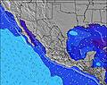 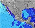 | 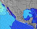 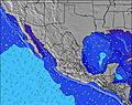 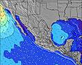 | 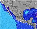 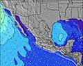 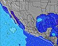 | 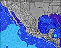 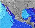 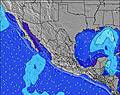 | 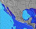 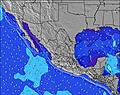 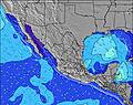 | |||||||||||||||||||||||||||||||||||||||||||||||||||
| Wave Height (m) & direction (?) | ||||||||||||||||||||||||||||||||||||||||||||||||||||||||||||
| Period(s) (?) | 14 | 20 | 20 | 20 | 20 | 19 | 13 | 19 | 18 | 18 | 18 | 18 | 18 | 17 | 16 | 16 | 16 | 16 | 16 | 16 | 16 | 15 | 16 | 15 | 15 | 15 | 15 | 16 | 16 | 16 | 16 | 16 | 16 | 16 | 16 | 16 | 15 | 15 | 15 | 14 | 14 | 14 | 14 | 14 | 14 | 14 | 13 | 13 | 13 | 13 | 19 | 19 | 19 | 13 | 18 | 18 | 18 | 18 | 18 | 17 |
Wave (?)Graph | ||||||||||||||||||||||||||||||||||||||||||||||||||||||||||||
| Energy (?) | 630 | 790 | 1014 | 1171 | 1089 | 716 | 440 | 506 | 1118 | 1505 | 1505 | 1505 | 817 | 740 | 1081 | 1055 | 1055 | 1179 | 1245 | 776 | 1230 | 621 | 573 | 683 | 880 | 773 | 773 | 1376 | 1360 | 1550 | 1327 | 1150 | 1136 | 1261 | 1261 | 1230 | 1182 | 1010 | 936 | 800 | 800 | 800 | 687 | 687 | 678 | 633 | 361 | 345 | 277 | 277 | 303 | 376 | 360 | 396 | 214 | 316 | 455 | 711 | 711 | 695 |
Wind (km/h) | ||||||||||||||||||||||||||||||||||||||||||||||||||||||||||||
| Wind State (?) onshore cross-onshore cross-shore cross-offshore offshore glassy | glass | glass | glass | glass | glass | on | on | cross- on | cross- on | glass | cross- off | cross- off | cross | cross- on | cross- on | cross- on | cross | glass | glass | cross- off | cross- on | on | cross- on | cross- on | glass | glass | glass | glass | glass | on | on | cross- on | glass | glass | glass | glass | glass | on | cross- on | cross- on | glass | glass | glass | cross- off | glass | on | on | on | glass | glass | cross- off | glass | cross- on | on | cross- on | cross- on | cross | glass | glass | glass |
High Tide / height (m) | 9:59PM 0.67 | 9:41AM 0.57 | 9:56PM 0.62 | 9:58AM 0.57 | 9:43PM 0.59 | 10:18AM 0.57 | 9:23PM 0.57 | 10:45AM 0.55 | 8:54PM 0.57 | 11:20AM 0.51 | 8:16PM 0.60 | 7:47PM 0.64 | 7:44PM 0.70 | |||||||||||||||||||||||||||||||||||||||||||||||
Low Tide / height (m) | 4:00AM 0.28 | 3:38PM 0.23 | 4:04AM 0.27 | 3:52PM 0.30 | 4:07AM 0.26 | 3:58PM 0.37 | 4:08AM 0.24 | 3:46PM 0.44 | 4:07AM 0.22 | 2:45PM 0.48 | 4:04AM 0.20 | 4:04AM 0.19 | 4:07AM 0.19 | |||||||||||||||||||||||||||||||||||||||||||||||
Friday 19 | Saturday 20 | Sunday 21 | Monday 22 | Tuesday 23 | Wednesday 24 | Thursday 25 | Friday 26 | |||||||||||||||||||||||||||||||||||||||||||||||||||||
| Sunrise | - | - | - | - | 7:26 | - | - | - | - | - | - | - | 7:26 | - | - | - | - | - | - | - | 7:26 | - | - | - | - | - | - | - | 7:24 | - | - | - | - | - | - | - | 7:24 | - | - | - | - | - | - | - | 7:24 | - | - | - | - | - | - | - | 7:22 | - | - | - | - | - | - | - |
| Sunset | - | - | - | - | - | - | - | 8:04 | - | - | - | - | - | - | - | 8:04 | - | - | - | - | - | - | - | 8:05 | - | - | - | - | - | - | - | 8:05 | - | - | - | - | - | - | - | 8:05 | - | - | - | - | - | - | - | 8:05 | - | - | - | - | - | - | - | 8:06 | - | - | - | - |
Rain (mm) | - | - | - | - | - | - | - | - | - | - | - | - | - | - | - | - | - | - | - | - | - | - | - | - | - | - | - | - | - | - | - | - | - | - | - | - | - | - | - | - | - | - | - | - | - | - | - | - | - | - | - | - | - | - | - | - | - | - | - | - |
| Temp. °C | 24 | 24 | 24 | 24 | 25 | 26 | 26 | 25 | 25 | 24 | 23 | 23 | 25 | 26 | 26 | 26 | 24 | 24 | 23 | 23 | 25 | 26 | 26 | 25 | 24 | 24 | 23 | 22 | 25 | 26 | 26 | 25 | 24 | 24 | 23 | 23 | 26 | 26 | 27 | 26 | 25 | 24 | 24 | 24 | 26 | 27 | 26 | 26 | 25 | 25 | 24 | 24 | 26 | 26 | 27 | 26 | 25 | 24 | 24 | 23 |
| Feels °C (?) | 27 | 27 | 26 | 27 | 27 | 27 | 26 | 26 | 27 | 26 | 24 | 24 | 25 | 26 | 26 | 27 | 26 | 27 | 25 | 24 | 26 | 27 | 26 | 26 | 26 | 27 | 26 | 24 | 27 | 26 | 27 | 26 | 26 | 26 | 24 | 24 | 27 | 26 | 27 | 27 | 28 | 26 | 26 | 24 | 26 | 28 | 26 | 28 | 28 | 27 | 25 | 25 | 26 | 26 | 27 | 27 | 27 | 27 | 27 | 25 |
FREE! Surf-Forecast.com widget for your website
The surf report / weather widget below is available to embed on third party websites free of charge and provides a summary of our Manzanillo surf forecast. Simply grab the html code snippet that we provide and paste it into your own site. You can choose your preferred language and metric/imperial units for the surf forecast feed to suit users of your site. Click here to get the code.


 Nearest