
Previsiones:

Actualizaciones en hora min s Forecast update imminent
Pronóstico Corto PlazoLluvia ligera (totál 6mm), cayendo mayormente el jueves por la mañana. Very mild (max 19°C el jueves por la tarde, min 13°C el martes por la noche). Vientos crecientes (Vientos ligeros desde el ENE el martes por la noche, vientos frescos desde el SO por la noche de jueves). | ||||||||||||||||||||||||
Tuesday 9 | Wednesday 10 | Thursday 11 | Fri 12 | |||||||||||||||||||||
5 AM | 8 AM | 11 AM | 2 PM | 5 PM | 8 PM | 11 PM | 2 AM | 5 AM | 8 AM | 11 AM | 2 PM | 5 PM | 8 PM | 11 PM | 2 AM | 5 AM | 8 AM | 11 AM | 2 PM | 5 PM | 8 PM | 11 PM | 2 AM | |
Mapa de Altura de Olas |  |  | 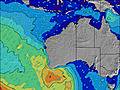 | 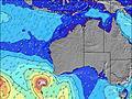 |  |  | 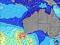 |  | 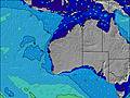 | |||||||||||||||
Oleaje Altura (m) Dirección Período (s) | WSW 14 | WSW 15 | WSW 15 | WSW 16 | WSW 16 | WSW 16 | WSW 16 | WSW 16 | WSW 16 | WSW 15 | WSW 15 | WSW 15 | WSW 15 | WSW 15 | WSW 14 | WSW 14 | WSW 14 | WSW 14 | WSW 14 | WSW 14 | WSW 16 | WSW 16 | WSW 17 | WSW 17 |
Gráfico Olas | ||||||||||||||||||||||||
7317 | 7864 | 7984 | 7468 | 7081 | 6035 | 5229 | 4590 | 3905 | 3371 | 2655 | 2322 | 1939 | 1822 | 1415 | 1728 | 1364 | 1280 | 1413 | 1553 | 2295 | 3005 | 3724 | 3475 | |
Viento (km/h) | ||||||||||||||||||||||||
Estado del Viento Viento de Mar Viento de Mar-Cruzado Cruzado Viento de Tierra-Cruzado Viento de Tierra Cristalino | cross-on | cross-on | cross-on | cross | cross | cross-off | off | cross-off | cross-off | cross-off | cross-off | cross | cross-on | cross-on | cross-on | cross-on | cross-on | cross | cross | on | on | on | cross-on | cross-on |
Marea alta | 6:13AM0.47m | 6:19AM0.53m | 6:52PM0.28m | 6:37AM0.60m | ||||||||||||||||||||
Marea baja | 9:45PM0.23m | 3:11PM0.24m | 9:39PM0.26m | 3:32PM0.14m | ||||||||||||||||||||
7:11 | — | — | — | — | — | — | — | 7:13 | — | — | — | — | — | — | — | 7:13 | — | — | — | — | — | — | 7:13 | |
— | — | — | — | 5:19 | — | — | — | — | — | — | — | 5:19 | — | — | — | — | — | — | — | 5:19 | — | — | 5:19 | |
mm | 2 | — | — | — | — | — | — | — | — | — | — | — | — | — | — | — | — | 1 | 1 | 1 | 1 | 1 | 1 | — |
Temp. °C | 16 | 15 | 14 | 14 | 14 | 13 | 13 | 13 | 13 | 13 | 14 | 17 | 17 | 17 | 17 | 17 | 17 | 16 | 16 | 19 | 18 | 18 | 17 | 16 |
Enfriamiento °C | 8 | 8 | 8 | 9 | 10 | 10 | 11 | 11 | 10 | 10 | 10 | 13 | 13 | 12 | 12 | 13 | 15 | 13 | 12 | 14 | 13 | 12 | 10 | 9 |
Oleaje 1 Altura (m) Dirección Período (s) | — | — | WSW 15 | WSW 16 | WSW 16 | WSW 16 | WSW 16 | WSW 16 | WSW 16 | WSW 15 | WSW 15 | WSW 15 | WSW 15 | WSW 15 | WSW 14 | WSW 14 | WSW 14 | WSW 14 | WSW 14 | — | W 21 | — | WSW 17 | — |
— | — | 7984 | 7468 | 7081 | 6035 | 5229 | 4590 | 3905 | 3371 | 2655 | 2322 | 1939 | 1822 | 1415 | 1728 | 1364 | 1280 | 1413 | — | 216 | — | 2139 | — | |
Oleaje 2 Altura (m) Dirección Período (s) | — | — | — | — | — | — | — | — | — | — | — | — | — | — | — | — | — | — | — | — | — | — | — | — |
— | — | — | — | — | — | — | — | — | — | — | — | — | — | — | — | — | — | — | — | — | — | — | — | |
Oleaje 3 Altura (m) Dirección Período (s) | — | — | — | — | — | — | — | — | — | — | — | — | — | — | — | — | — | — | — | — | — | — | — | — |
— | — | — | — | — | — | — | — | — | — | — | — | — | — | — | — | — | — | — | — | — | — | — | — | |
Olas de Viento Altura (m) Dirección Período (s) | WSW 14 | WSW 15 | — | — | — | — | — | — | — | — | — | — | — | — | WNW 5 | — | — | — | — | WSW 14 | WSW 16 | WSW 16 | WSW 17 | WSW 17 |
7317 | 7864 | — | — | — | — | — | — | — | — | — | — | — | — | 49 | — | — | — | — | 1553 | 2295 | 3005 | 3724 | 3475 | |
Viento del Tierra o Mar Limpio más proximo | ||||||||||||||||||||||||
Distancia (km) | 1135 | 1135 | 1135 | 189 | 5 | 5 | 5 | 0 | 0 | 0 | 0 | 23 | 355 | 151 | 297 | 339 | 117 | 16 | 297 | 373 | 373 | 403 | 403 | 2023 |
Mejores Olas Previstas en Perth City Coast | ||||||||||||||||||||||||
Mejores Olas Previstas en Australia | ||||||||||||||||||||||||
Header Global | ||||||||||||||||||||||||
- Map Icons:
 Break
Break Live Wave Height (m)
 Live Wind Speed (km/h)
 Surf Rating (10 Max)
 Ocean Swells (m)
- Wind Speed (km/h)
GRÁTIS! Un widget de Surf-Forecast.com para tu sitio
Este widget grátis de previsiones de surf y tiempo puede ser añadido a cualquier otro sitio y da un resumen de previsiones de olas para City Beach groyne. Solo necesita cortar y pegar el código HTML de abajo en su web. Puede elegir preferencias de idioma y de unidades (métricas o imperiales) para convenir a los usuarios de su sitio. Clica aquí para obtener el código.
 Nearest