

- Forecast
- Maps
- Live
- Weather State
- Spot Information

Surf Forecasts
Reef
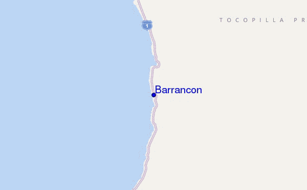
Barrancon surf Forecast / Tarapaca / Chile
48hr Weather and Surf, issued 1 pm Thursday 25 Apr 2024 -04
Forecast update in hr min s Update imminent
Barrancon surf forecast is for near shore open water. Breaking waves will often be smaller at less exposed spots.
Today's Barrancon sea temperature is 19.0°C (Statistics for 25 Apr 1981-2005 - mean: 19.6 °C max: 21.4 °C min: 18.0 °C)
- Map Icons:
 Break
Break Live Wave Height (m)
 Live Wind Speed (km/h)
 Surf Rating (10 Max)
 Ocean Swells (m)
- Wind Speed (km/h)
Barrancon surf forecast is for near shore open water. Breaking waves will often be smaller at less exposed spots.
Today's Barrancon sea temperature is 19.0°C (Statistics for 25 Apr 1981-2005 - mean: 19.6 °C max: 21.4 °C min: 18.0 °C)
How big are the waves at Barrancon today?
The current surf forecast for Barrancon at 5PM is: 1.4m 16s primary swell from a Southwest direction and 0.2m 13s secondary swell from a West-northwest direction (forecast issued at 01:00pm April 25). The wind direction is predicted to be cross-onshore and the swell rating is 3.
| Time (-04) & Date | Wave Height | Wave Period |
|---|---|---|
| Morning (25 Apr) | 3.5ft (1.1m) | 16s |
| Afternoon (25 Apr) | 4ft (1.2m) | 16s |
| Evening (25 Apr) | 4ft (1.2m) | 15s |
Table - waves today at Barrancon. (Swell directed towards the surf break)
Updates in hr min s Update imminent
Thursday 25 | Friday 26 | Saturday 27 | Sunday 28 | Monday 29 | Tuesday 30 | Wednesday 01 | Thursday 02 | |||||||||||||||||||||||||||||||||||||||||||||||||||||
| 11 AM | 2 PM | 5 PM | 8 PM | 11 PM | 2 AM | 5 AM | 8 AM | 11 AM | 2 PM | 5 PM | 8 PM | 11 PM | 2 AM | 5 AM | 8 AM | 11 AM | 2 PM | 5 PM | 8 PM | 11 PM | 2 AM | 5 AM | 8 AM | 11 AM | 2 PM | 5 PM | 8 PM | 11 PM | 2 AM | 5 AM | 8 AM | 11 AM | 2 PM | 5 PM | 8 PM | 11 PM | 2 AM | 5 AM | 8 AM | 11 AM | 2 PM | 5 PM | 8 PM | 11 PM | 2 AM | 5 AM | 8 AM | 11 AM | 2 PM | 5 PM | 8 PM | 11 PM | 2 AM | 5 AM | 8 AM | 11 AM | 2 PM | 5 PM | 8 PM | |
Rating (10 max) | ||||||||||||||||||||||||||||||||||||||||||||||||||||||||||||
Swell Height Map |    |    |    |    | 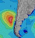 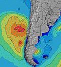 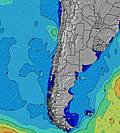 | 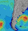 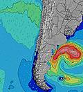 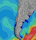 | 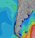 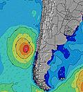 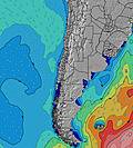 | 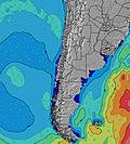 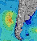 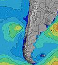 | ||||||||||||||||||||||||||||||||||||||||||||||||||||
| Wave Height (m) & direction (?) | ||||||||||||||||||||||||||||||||||||||||||||||||||||||||||||
| Period(s) (?) | 16 | 16 | 16 | 16 | 15 | 15 | 15 | 15 | 15 | 16 | 16 | 16 | 16 | 15 | 15 | 14 | 14 | 14 | 14 | 14 | 10 | 14 | 17 | 16 | 16 | 16 | 16 | 15 | 15 | 15 | 14 | 14 | 14 | 14 | 14 | 14 | 13 | 13 | 13 | 13 | 13 | 13 | 13 | 16 | 16 | 16 | 16 | 16 | 15 | 15 | 14 | 14 | 14 | 14 | 14 | 14 | 14 | 13 | 14 | 14 |
Wave (?)Graph | ||||||||||||||||||||||||||||||||||||||||||||||||||||||||||||
| Energy (?) | 674 | 674 | 1031 | 649 | 584 | 584 | 740 | 730 | 740 | 811 | 832 | 832 | 822 | 770 | 623 | 701 | 763 | 1321 | 476 | 553 | 348 | 437 | 2351 | 2290 | 2503 | 2629 | 2756 | 2720 | 2299 | 2042 | 1987 | 1724 | 1560 | 1538 | 1349 | 1204 | 1061 | 888 | 875 | 784 | 722 | 630 | 610 | 612 | 688 | 1358 | 1324 | 1379 | 1241 | 1024 | 1389 | 1370 | 1582 | 1960 | 2061 | 1973 | 1944 | 1778 | 1805 | 1697 |
Wind (km/h) | ||||||||||||||||||||||||||||||||||||||||||||||||||||||||||||
| Wind State (?) onshore cross-onshore cross-shore cross-offshore offshore glassy | cross | cross | cross- on | cross- on | glass | glass | cross | cross- on | cross | cross | cross | cross- on | cross- on | glass | glass | glass | cross- off | cross- off | cross- on | cross- on | glass | glass | glass | glass | glass | glass | glass | glass | glass | glass | glass | glass | glass | cross | cross- on | cross- on | glass | glass | cross- on | cross | cross | cross | cross | cross- on | cross- on | glass | cross- on | cross- on | cross | cross | cross | cross- on | glass | glass | cross- on | cross- on | cross | cross | cross | cross- on |
High Tide / height (m) | 10:11AM 1.09 | 10:26PM 0.73 | 10:46AM 1.09 | 11:03PM 0.66 | 11:24AM 1.07 | 11:45PM 0.60 | 12:08PM 1.04 | 12:36AM 0.54 | 1:00PM 1.02 | 1:46AM 0.51 | 2:02PM 1.00 | 3:13AM 0.52 | 3:09PM 1.00 | 4:33AM 0.58 | 4:16PM 1.02 | |||||||||||||||||||||||||||||||||||||||||||||
Low Tide / height (m) | 4:45PM 0.15 | 4:05AM 0.16 | 5:28PM 0.18 | 4:33AM 0.19 | 6:16PM 0.21 | 5:05AM 0.23 | 7:14PM 0.24 | 5:43AM 0.27 | 8:24PM 0.25 | 6:36AM 0.31 | 9:38PM 0.23 | 7:52AM 0.35 | 10:40PM 0.19 | 9:28AM 0.36 | ||||||||||||||||||||||||||||||||||||||||||||||
Thursday 25 | Friday 26 | Saturday 27 | Sunday 28 | Monday 29 | Tuesday 30 | Wednesday 01 | Thursday 02 | |||||||||||||||||||||||||||||||||||||||||||||||||||||
| Sunrise | - | - | - | - | - | - | - | 6:56 | - | - | - | - | - | - | - | 6:56 | - | - | - | - | - | - | - | 6:58 | - | - | - | - | - | - | - | 6:58 | - | - | - | - | - | - | - | 6:58 | - | - | - | - | - | - | - | 6:58 | - | - | - | - | - | - | - | 6:58 | - | - | - | - |
| Sunset | - | - | 6:19 | - | - | - | - | - | - | - | 6:17 | - | - | - | - | - | - | - | 6:17 | - | - | - | - | - | - | - | 6:16 | - | - | - | - | - | - | - | 6:15 | - | - | - | - | - | - | - | 6:15 | - | - | - | - | - | - | - | 6:15 | - | - | - | - | - | - | - | 6:14 | - |
Rain (mm) | - | - | - | - | - | - | - | - | - | - | - | - | - | - | - | - | - | - | - | - | - | - | - | - | - | - | - | - | - | - | - | - | - | - | - | - | - | - | - | - | - | - | - | - | - | - | - | - | - | - | - | - | - | - | - | - | - | - | - | - |
| Temp. °C | 23 | 23 | 21 | 21 | 20 | 20 | 20 | 20 | 22 | 22 | 21 | 21 | 21 | 20 | 19 | 20 | 22 | 23 | 21 | 20 | 20 | 20 | 20 | 20 | 22 | 22 | 21 | 20 | 20 | 19 | 20 | 20 | 22 | 22 | 21 | 20 | 20 | 20 | 20 | 20 | 22 | 22 | 21 | 20 | 20 | 20 | 20 | 20 | 22 | 22 | 21 | 20 | 20 | 19 | 20 | 20 | 22 | 21 | 20 | 19 |
| Feels °C (?) | 23 | 23 | 20 | 22 | 21 | 21 | 20 | 20 | 22 | 21 | 21 | 21 | 21 | 21 | 20 | 22 | 23 | 24 | 22 | 20 | 21 | 22 | 21 | 21 | 23 | 23 | 22 | 21 | 21 | 20 | 21 | 20 | 23 | 23 | 21 | 20 | 21 | 21 | 21 | 20 | 22 | 22 | 21 | 20 | 20 | 21 | 20 | 20 | 22 | 22 | 21 | 21 | 21 | 20 | 20 | 20 | 21 | 20 | 20 | 19 |
FREE! Surf-Forecast.com widget for your website
The surf report / weather widget below is available to embed on third party websites free of charge and provides a summary of our Barrancon surf forecast. Simply grab the html code snippet that we provide and paste it into your own site. You can choose your preferred language and metric/imperial units for the surf forecast feed to suit users of your site. Click here to get the code.


 Nearest